INDUSTRY SOLUTIONS turn your data into Actionable Information Confident Decisions.
Whether you are a defense analyst who supplies actionable
information to support a mission or a utilities professional who
needs to efficiently maintain assets across a system, our data and
software solutions give you the confidence to make better decisions.
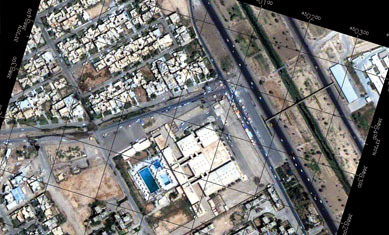
Defense and Intelligence Solutions turn geospatial imagery and data into timely, accurate, and actionable
intelligence. Defense and intelligence personnel rely on our industry-leading software tools to turn geospatial imagery and data into timely,
accurate, and actionable intelligence. Our custom and off-the-shelf
solutions can be found on most analysts' systems because they are easy to learn, integrate with popular platforms such as ArcGIS® from
Esri, and are scientifically proven for high-confidence decision making.
Fed/Civil Solutions
Data and Solutions for Floodplan Mapping, Disaster response, and Water Management & Distribution. Necessity to extract buildings footprints, model flood plains, or provide actionable intelligence
to first responders, Harris Geospatial can provide a solution that meets your needs.
Maritime Solutions
Unparalleled Maritime Domain Awareness and Global Vessel Tracking.
Harris has partnered with exactEarth Ltd to offer a full range of Satellite Automatic Identification System (S-AIS) data services and
products to provide
the most timely and accurate information available
to run any maritime operation safer and more efficiently than ever before.
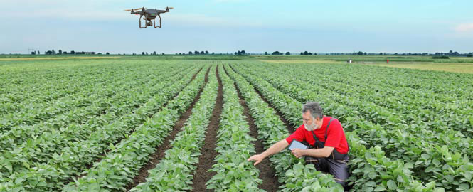
Precision Agriculture Harris can help Ag businesses tailor crop management decisions by using modern precision agriculture techniques – scientifically proven approaches
that analyze remotely sensed data such as satellite and UAV imagery.
Utilities Solutions Safely, Reliable, and Efficiently Manage your Network.
Harris has solutions that leverage remotely sensed data and powerful analytics that take utility asset management to the next level. Use our Geiger-mode LiDAR, advanced ENVI analytics, and machine learning technology to get a clear understanding of the condition and location of your
infrastructure so you can safely, reliably,
and efficiently manage your network.
© 2018 bup.rubin-tec.co.il

